Water is a precious commodity, and not just as drinking water. The littoral zones of coastal waters, rivers and lakes offer a diverse landscape: beaches, floodplains, reed beds, shoreline plants and woody plants. They are not only a habitat for many animals and plants. People also find recreation on hiking trails or swimming in nature. For some economic sectors, like fishing, shipbuilding or tourism, water is the basis of existence.
Water management is the deliberate organization of all human interventions on surface and ground water. It is therefore not limited to the use of water alone: for example, water protection is about protecting water from humans, while flood protection is about protecting humans from water.
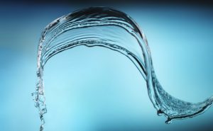
Rainwater harvesting in the home
Rainwater harvesting in the home reduces drinking water consumption and helps preserve water resources. This ecological and economical method involves collecting rainwater that falls on the roofs of homes and storing it in tanks (cisterns) for later use.
The advantages of rainwater harvesting are twofold:
- It reduces drinking water consumption by using rainwater for non-drinking purposes such as watering plants, cleaning floors, flushing toilets or washing cars. By reducing the demand for drinking water, households can save on their water bills and help relieve pressure on water supply networks.
- Rainwater harvesting helps reduce stormwater runoff and prevent flooding in urban areas. Indeed, when rainfall is heavy, rainwater can run off quickly into streets and sewers, causing overflows and flooding. By collecting rainwater, it’s possible to reduce the volume of water flowing into the sewer system and limit the risk of flooding.
Objectives of Good Water Management
The improvement of wastewater treatment has meanwhile helped to turn polluted water into clean lakes and rivers in many cases. However, the development of water bodies – straightening, damming and diverting rivers – has had the effect of increasingly damaging the plant and animal population. For too long, bodies of water have been regarded as mere receiving waters for the harmless drainage of rainwater. But a stream is more than a drainage channel with good water quality; it is a natural habitat for many plants and animals, an area of ecological diversity. What’s more, if riparian buffers, with their shady trees and bushes, are removed, nutrients and pollutants from adjacent areas enter rivers and lakes more quickly and unfiltered.
The objective of water management today is to protect or restore the ecological functions of water bodies in their entirety and – in connection with this – the diversity of landscapes shaped by water bodies. Watercourses must be renaturalized, nutrient and pollutant inputs from land use must be more strongly restricted and wastewater must be purified so that it no longer endangers water bodies. Following the adoption of the Water Framework Directive, these objectives apply throughout Europe according to the same principles and objectives.
Water protection is therefore a special obligation for us today and in the future. So let’s move to new shores – more nature for our water. Because more water protection means more quality of life.